Skip to Content
|
Online Services
|
Commonwealth Sites
|
Help
|
Governor
Search Virginia.gov:
Contact Us
Home
Home
State Parks
Soil and Water
Conservation
Natural Heritage
Dam Safety and
Floodplain Management
Outdoor Recreation
Planning, Trails
and Grants
Chesapeake Bay
Local Assistance
Land Conservation
Boards and
Foundations
Special Events
Jobs
About Us
Park
Locations
Cabins,
Camping
Prices,
Fees
Park
Events
Reservation
Center
All Park
Offerings
VIRGINIA STATE PARKS
Park Locations
Douthat State Park
Douthat State Park, which is on the National Register of Historic Places, straddles Bath and Alleghany counties.
Raymond R. “Andy” Guest Jr. Shenandoah River State Park
Shenandoah River Raymond R. “Andy” Guest, Jr., State Park is 1,604 acres with 5.6 miles of river frontage along the south fork of the Shenandoah River.
Sky Meadows State Park
Just an hour from Washington, D.C., Sky Meadows State Park in Clarke and Fauquier counties offers a peaceful getaway just east of the Blue Ridge Mountains.
Lake Anna State Park
Lake Anna State Park has more than 13 miles of hiking trails, lakeshore picnicking, a guarded swimming beach, a children’s play area, a boat ramp, a food concession stand, a bathhouse and a children’s and handicapped fishing pond.
Leesylvania State Park
Leesylvania, which has a top-notch marina, opened in 1992. In 1978, noted philanthropist Daniel Ludwig donated the land to the state for a park.
Mason Neck State Park
Mason Neck State Park is on a peninsula formed by Pohick Bay on the north, Belmont Bay on the south and the Potomac River on the east.
Belle Isle State Park
Belle Isle State Park is a window to the beautiful lower Rappahannock River in Lancaster County.
Caledon Natural Area
A designated natural landmark, Caledon offers visitors a unique chance to view bald eagles in their natural habitat.
Chippokes Plantation State Park
Chippokes Plantation State Park is one of the oldest working farms in the United States.
False Cape State Park
Located in southern Virginia Beach, False Cape State Park is an isolated, mile-wide barrier spit between the Back Bay and Atlantic Ocean.
First Landing State Park
First Landing offers boating, swimming, nature and history programs, camping, hiking, biking, picnicking, a boat launch, cabins and 19 miles of trails on 2,888 acres.
Kiptopeke State Park
Located on the eastern shore of Virginia, Kiptopeke State Park offers recreational access to the Chesapeake Bay and the chance to explore a unique coastal habitat featuring a major flyway for migratory birds.
Westmoreland State Park
Westmoreland State Park extends about one and a half miles along the Potomac River, and its 1,299 acres neighbor the former homes of both George Washington and Robert E. Lee.
York River State Park
Eleven miles west of Williamsburg, York River State Park offers visitors an opportunity to experience the environment of a coastal estuary.
Bear Creek Lake State Park
Nestled in the heart of Cumberland State Forest less than an hour west of Richmond, Bear Creek Lake is the perfect getaway for the outdoor enthusiast.
Fairy Stone State Park
Fairy Stone State Park, the largest of Virginia's six original state parks, is home to its namesake fairy stones.
Holliday Lake State Park
Deep in the heart of Appomattox-Buckingham State Forest, Holliday Lake State Park is a paradise for the outdoor enthusiast.
James River State Park
James River State Park has numerous options for overnight stays, and it offers access to nearly 20 miles of hiking, biking and horseback riding trails.
Occoneechee State Park
Occoneechee State Park is on Virginia’s largest lake, Buggs Island Lake, also known as John H. Kerr Reservoir.
Pocahontas State Park
Just 20 miles from downtown Richmond, Pocahontas State Park has been one of the more popular parks in the state park system.
Sailor's Creek Battlefield Historic State Park
Sailor's Creek Battlefield State Park is a great place to stop for lunch as it is roughly midway between Petersburg and Appomattox Court House.
Smith Mountain Lake State Park
Situated on the second largest body of freshwater in the state, Smith Mountain Lake State Park offers activities for outdoor enthusiasts of all kinds.
Staunton River Battlefield State Park
Here at historic Staunton River Battlefield State Park, a ragtag group of Confederate old men and young boys beat the odds and held off an assault by 5,000 Union troops.
Staunton River State Park
The 1,600-acre Staunton River State Park is along the shoreline of the John H. Kerr Reservoir (also known as Buggs Island Lake), as well as the Dan and Staunton rivers.
Twin Lakes State Park, Cedar Chest Conference Center
Twin Lakes State Park, centrally located in Virginia's Piedmont, provides visitors from around the state with a variety of lakefront activities in a secluded setting.
Breaks Interstate Park
The Breaks Interstate Park is one of two interstate parks in America; the park has the deepest gorge east of the Mississippi and encompasses 4,500 acres of woodland.
Claytor Lake State Park
Located on the 4,500-acre, 21-mile long Claytor Lake in the New River valley of southwestern Virginia, Claytor Lake State Park offers many activities for water and land enthusiasts.
Grayson Highlands State Park
Grayson Highlands State Park is adjacent to the Mount Rogers National Recreation Area in the Jefferson National Forest.
Hungry Mother State Park, Hemlock Haven Conference Center
Hungry Mother State Park in southwestern Virginia is noted for its woodlands and lake.
Natural Tunnel State Park, Cove Ridge Center
Natural Tunnel, called the Eighth Wonder of the World by William Jennings Bryan, has attracted sightseers to southwestern Virginia for more than 100 years.
New River Trail State Park and Shot Tower
New River Trail State Park, designated an official National Recreation Trail by the U.S. Department of the Interior, parallels 39 miles of the New River.
Shot Tower
Overlooking the New River, Shot Tower was built more than 150 years ago to make ammunition for the firearms of the early settlers.
Southwest Virginia Museum Historical State Park
The Southwest Virginia Museum chronicles the exploration and development of the town and surrounding area during the 1890s coal boom, as well as the pioneer period.
Wilderness Road State Park
Wilderness Road State Park was bought in 1993; its 200 acres straddle the Wilderness Road.
Alphabetical List of Virginia State Parks:
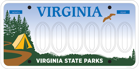
Bear Creek Lake State Park (12)
Belle Isle State Park (6)
Breaks Interstate Park (31)
Caledon Natural Area (8)
Chippokes Plantation State Park (4)
Claytor Lake State Park (26)
Douthat State Park (23)
Fairy Stone State Park (19)
False Cape State Park (2)
First Landing State Park (3)
Grayson Highlands State Park (27)
Holliday Lake State Park (13)
Hungry Mother State Park, Hemlock Haven Conference Center (28)
James River State Park (14)
Kiptopeke State Park (1)
Lake Anna State Park (9)
Leesylvania State Park (10)
Mason Neck State Park (11)
Natural Tunnel State Park, Cove Ridge Center (32)
New River Trail State Park (29)
Occoneechee State Park (20)
Pocahontas State Park (15)
Raymond R. “Andy” Guest Jr. Shenandoah River State Park (24)
Sailor’s Creek Battlefield Historic State Park (16)
Shot Tower (30)
Sky Meadows State Park (25)
Smith Mountain Lake State Park (17)
Southwest Virginia Museum Historical State Park (33)
Staunton River Battlefield State Park (22)
Staunton River State Park (21)
Tabb Monument Historic Site
Twin Lakes State Park, Cedar Chest Conference Center (18)
Westmoreland State Park (7)
Wilderness Road State Park (34)
York River State Park (5)
By number
Kiptopeke
False Cape
First Landing
Chippokes Plantation
York River
Belle Isle
Westmoreland
Caledon Natural Area
Lake Anna
Leesylvania
Mason Neck
Bear Creek Lake
Holliday Lake
James River
Pocahontas
Sailor's Creek Battlefield Historic
Smith Mountain Lake
Twin Lakes
Fairy Stone
Occoneechee
Staunton River
Staunton River Battlefield
Douthat
Shenandoah River Raymond R. "Andy" Guest Jr.
Sky Meadows
Claytor Lake
Grayson Highlands
Hungry Mother
New River Trail
Shot Tower
Breaks Interstate
Natural Tunnel
Southwest Virginia Museum Historical
Wilderness Road
Tabb Monument
Click here to view a map of DCR's natural areas with public access.