Open fires are prohibited throughout the park from midnight to 4 p.m., now through April 30. Learn more.
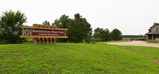
Machicomoco State Park
3601 Timberneck Farm Road, Hayes, VA 23072; Phone: 804-642-2419; Email: machicomoco@dcr.virginia.gov
Latitude, 37.3112469. Longitude, -76.5417781.

The park is open 8 a.m. to dusk. The park office is open Monday-Thursday, 9 a.m.-4 p.m., Friday-Saturday, 8 a.m.-5 p.m, and Sunday, 9 a.m.-5 p.m. The office may close due to staffing issues or during scheduled trainings.
Campsites and yurts are available for reservation.
Firewood is available at the campground. $10 per bundle and $5 cedar kindling bundles, cash only. Please come prepared because the park does not sell ice, food or drinks.
Please review the Virginia State Parks Know Before You Go information before you visit.
General Information
Located in the southern part of Gloucester County along the York River, Machicomoco State Park is approximately 10 miles downriver from Werowocomoco. The landscape of Timberneck was most certainly associated with Tsenacommacah and Powhatan’s extensive Chiefdom.
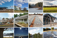
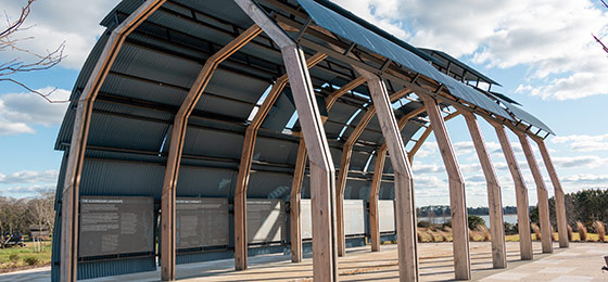
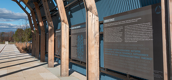
An open-air interpretive pavilion provides information on the culture, landscape and movement of Virginia Indians through displays and a walking path in the landscape. A paved trail follows along the main park road for walking or bike riding. The surrounding land provides diverse wildlife habitats, from open fields to woodlands and waterfront/marsh areas supporting deer, turkey, and many species of songbirds and birds of prey.
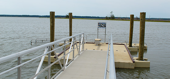
Other amenities include a campground with sites for vehicle camping and hike-in tent sites, three overnight yurts, two picnic shelters, a car-top boat launch pier with an accessible boat entry structure, and a set of small floating docks on Timberneck creek for daytime boat tie-ups and fishing.
Hours
8 a.m. to dusk
Location
The park's address is 3601 Timberneck Farm Road, Hayes, Virginia 23072. Latitude, 37° 18' 40.48⁰N, Longitude, -76° 32' 30.40⁰W.
Drive Time: Northern Virginia, three and a half hours; Richmond, one and a half hours; Norfolk/Virginia Beach, one and a half hours; Roanoke, four hours.
Directions:
From Richmond, take I-64 east to exit 220 for VA-33 toward West Point. Turn right onto State Rte. 14/Buena Vista Rd. Turn right onto US-17S. Travel 21 miles and make a right turn on Providence Road (do not use Piney Swamp Road). Follow Providence Road approximately 1.5 miles, and make a left onto Borden Road. At the end of the road, approximately .69 mile, turn left at the circle onto Timberneck Farm Road to the park entry gate.
From Tidewater, take I-64 west to exit 258 for US-17N toward Gloucester County. Cross the George P. Coleman Bridge ($2 toll), turn left onto Providence Road, Follow approximately 1.5 miles and make a left onto Borden Road. At the end of the road, approximately .7 mile, turn left at the circle onto Timberneck Farm Road to the park entry gate.
Park Size
645 acres
Share this page
Cabins, camping
OVERNIGHT FACILITIES
Camping with sites for vehicle camping as well as hike-in tent sites and three overnight yurts
For information on the availability of overnight accommodations, particular park amenities or to make a reservation, you can reserve online or call 1-800-933-PARK.
Park fees
Reservation cancellation and transfer policies.
View photos of sites.
The park does not sell ice, food or drinks.
Cabins
None in the park, but nearby Belle Isle and Chippokes state parks have cabins.
Yurts
The park has three yurts in the main campground. Recreational yurts are a modern adaptation of an ancient nomadic shelter. Functionally speaking, they’re a cross between a tent and a cabin. Each yurt has a large wooden deck. A picnic table and a fire ring with a cooking grate are located adjacent to the yurt deck. Reservations are required. Parking for two vehicles is allowed. Those with additional vehicles must pay a daily parking fee and park in a designated overflow lot.
Check-in is 4 p.m. and checkout is 10 a.m. The rental season begins on the first Friday in March and ends on the first Sunday of December. Cabin rental and cancellation policies apply. There is a two-night minimum rental during camping season.
Transfer and cancellation policies.
- Maximum occupancy four. Sleeps three. One queen-sized and a twin-sized trundle pull-out. Guests must bring sleeping bags or linens.
- No smoking, cooking or pets allowed in the yurt.
- A water spigot is available near the yurts, but no electricity.
- Dining table seats four and a couch.
- No heat or air-conditioning.
- Guests use the campground bathhouse.
- Yurt 3 is ADA-accessible.
Camping
The campground has a total of 27 campsites; 13 with electric and water hookups for various equipment – tents, popups and RVs up to 60 feet long; 14 walk-in tent-only sites. The campground offers no river views. Check-in is 4 p.m. and check-out is 1 p.m. Campers are welcome to arrive earlier but cannot be guaranteed a site until the official check-in time. All sites are available for site-specific reservations. The campground is open from the first Friday in March to the first Monday in December. The campground has a bathhouse with restrooms with hot showers. Sites have fire-rings, picnic tables and lantern holders. All sites are available through site-specific reservations.
See a chart with campsite details.
- Tents must fit on the 20’ by 20' tent pad.
- Outlets accept 20, 30 and 50-amp current.
- All camping equipment and vehicles, using electric and water sites, must fit on the designated campsite. Sites are limited to two camping units, only one of which may be axled. Site rental includes parking fees for no more than two vehicles. All additional vehicles must be parked in the overflow area. Customers must pay parking fees for additional vehicles.
- All walk-in campsites come with one designated parking space, other vehicles must be parked in the overflow area. Sites are limited to two camping units and all must fit within the designated borders of the campsite.
- The campsite and living spaces are filled with small gravel/pebbles.
- People visiting overnight guests must pay a daily parking fee and leave the park by 10 p.m.
- Quiet time is from 10 p.m. through 8 a.m.
- Campsites have round grills on the ground. The grill may be used to make a campfire or for cooking. Campfires are allowed only in the designated area.
Recreation
TRAILS
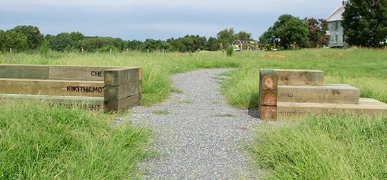
The park has a 3.3 mile paved foot/bicycle trail that circles the main road on the park site. A footpath of gravel, oyster shells and mown grass can be found at the interpretive area and totals .7 of a mile. The natural trail runs 2.4 miles from the interpretive area, through the car-top kayak launch, and near the campgrounds at the trailhead parking lot.
SWIMMING
There are no designated swimming areas.
FISHING, BOATING
The park has a car-top boat launch access point located at Poplar Creek. The launch access includes a pull-off to unload the boat and park in a separate parking area approximately 650 feet from the drop-off point. A hardened trail leads from the parking lot back to the drop-off point. Boats must be hand-carried from the drop-off point, along a paved trail to the launch pier, and out to the accessible float at the end of the pier. The total distance from the drop-off point to the water is approximately 350 feet, including the pier. This water body is very shallow and subject to mud low tides at various times of the year, so be sure to consult the local tide chart before using the areas. This waterway is also a part of the Chesapeake Bay National Estuarine Research Reserve, administered by the Virginia Institute of Marine Science. Access to the Catlett Islands and accompanying marsh areas is prohibited due to the sensitive nature of the resources. Please respect this resource and remain in your boat at all times. Motorized boats and boats launched from trailers are not permitted to use this access. Water access is closed from Nov. 1 through Jan. 31 to protect migratory waterfowl that use the area for overwintering.
Fishing is only permitted at the floating slips located on Timberneck Creek. A valid Virginia saltwater license is required from the Virginia Department of Marine Resources.
HORSES
No trails or facilities are currently available for equestrian use.
Park Trail Guide
Click here for the park's trail guide.
Download (external link for use with Avenza App) the geo-referenced map
Download the geo-referenced map for this park
Nearby Attractions
Nearby state parks: York River, Chippokes, Belle Isle, Pocahontas
Gloucester County has many restaurants, shops, farmers' markets, breweries, historic sites and other family-oriented activities. Visit the Gloucester Courthouse area to check out the main street art projects, outdoor wall murals, and the Werowocomoco and Pocahontas Exhibit at the Visitor Center. Additionally, Yorktown, located just over the Coleman Bridge to the south, has an extensive amount of history and outdoor activities. The National Park Service Unit, Colonial National Historical Park, provides history programs on the beginnings of the English colony and the battle for independence. More history can be found by visiting the Jamestown Settlement and the American Revolution Museum.
For more information, visit:
Gloucester Tourism Site https://gloucesterva.gov/tourism
Yorktown Tourism Site https://www.visityorktown.org
Colonial National Historical Park https://www.nps.gov/colo/index.htm
Jamestown Settlement & American Revolution Museum at Yorktown https://www.jyfmuseums.org/
Picnic Shelters
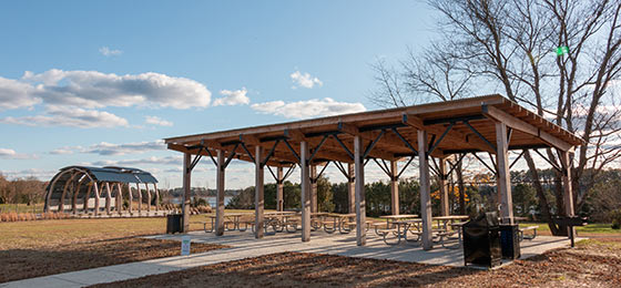
The park has two large picnic shelters, both of which are located in the interpretive area. Each has picnic tables and a charcoal grill. There is an electrical outlet at each shelter, however, amplified music is prohibited. Parking fees are not included with the shelter rental fees and must be paid upon entering the park. As throughout the park, alcohol is allowed only in private areas (e.g., in a cabin or camping unit) and areas covered by permits issued by the Virginia Department of Alcoholic Beverage Control, which must be approved by the park.
Shelter 1 is surrounded by grass and has a paved walkway to it. It is about 150 feet from a restroom and 50 feet from a parking lot. The land around the shelter is flat. It has 10 picnic tables
Shelter 2 is surrounded by grass. It is about 80 feet from a restroom and 50 feet from a parking lot. The land around the shelter is flat and looks out over the interpretive trail area. The shelter has 10 picnic tables.
Picnic shelters are available by reservation by calling the Customer Service Center at 800-933-PARK. Shelters can be rented from 8 a.m. to dusk (all day).
Park Fees
Cancellation policy: No refund within 14 days before the reserved date. Before then, there is a cancellation fee.
Meeting Space and Facilities
MEETING FACILITIES
The park has no indoor meeting facilities, but picnic shelters are available to rent year-round.
VISITOR CENTER, GIFT SHOP
The Park’s gift shop is at the main entrance building.
RESTAURANT
None within the park, but there are numerous nearby eateries in Gloucester County and its Courthouse area.
LAUNDRY
None currently at this site.
ENVIRONMENTAL EDUCATION CENTER
None on this site
SPECIAL FEATURES
The interpretive area of the park provides visitors with an opportunity to learn more about the history of Virginia Indians and how they are a critical part of our history today. The area includes a path of history with time blocks that tell of significant occurrences in the life of the Indigenous peoples of the area. This path leads to an open educational pavilion reminiscent of an Indian longhouse, where you can find additional information on Virginia Indian culture. From this structure, the path continues out into the landscape with a gravel, oyster shell and mown grass path, letting the visitor walk through the natural environment, see views of the river and land, and along the way learn some of the Algonquian language at locations of rest and reflection. Plantings of native trees, shrubs and other plants, all a part of Indian life for food, medicine and ceremonial purposes, surround the educational pavilion.
Adjacent to this space is the historic Timberneck House. The Fairfield Foundation, in partnership with the Commonwealth of Virginia, plans to restore the building and grounds to provide for additional educational and public programming, potential exhibit space and an overnight facility to support its mission of preservation and archeology research. To learn more about the foundation, visit their website Fairfieldfoundation.org.
Other Info
ACCESSIBILITY
- Restrooms: All are accessible.
- Yurt 3, campsite 16 (water and electric), campsites 21 and 22 (walk-in) and the campground bathhouse are accessible.
- Shelters: Extended picnic tables, concrete walkways from the parking lot to the shelter and a concrete floor.
- Parking: Designated parking areas are near the shelters, office, restrooms, car top boat launch and interpretive area
- Interpretive Trail and Loop Trail are accessible to devices for limited mobility.
NATURE, HISTORY PROGRAMS
The park will be developing programming for individuals, families and school groups in the future. Continue to watch this page for updates.
CONCESSIONS
None at this park.
HISTORY
Archeological evidence on Timberneck ranges from the Middle and Late Woodland Period. It includes two ancient shell middens, one dating from 100BCE to 500CE, and various procurement sites - camps used as a base for fishing, oystering and hunting by Virginia Tribes. Located approximately 10 miles downriver from Werowocomoco, the landscape of Timberneck was most certainly associated with Tsenacommacah and Powhatan's extensive Chiefdom. The English likely settled Timberneck around 1639, when George Minifye was granted a patent on the land. In 1792, the land was sold to John Catlett, and it remained in his family for the next two centuries and has been continuously commercially farmed since that time. The site is bountiful in natural resources, including land used for agriculture, maritime forest, marsh, uplands, wetlands, and estuarine habitat.
This park was developed as part of the Surry-Skiffes Creek Transmission Line Project memorandum of agreement mitigation stipulations. This mitigation agreement provided funding for land acquisition, visitor interpretation facilities, archeological investigation and preservation associated with Werowocomoco. The Conservation Fund purchased the Timberneck tract as part of this stipulation. Nelson Byrd Woltz Landscape Architects developed the design and managed construction for the site. The property was transferred to DCR on Oct. 9, 2020.
FRIENDS GROUP
Join the Friends of Machicomoco State Park today. Whether you’re an outdoor enthusiast, a nature lover, or simply someone who loves to support the community, the Friends of Machicomoco State Park welcome you with open arms. As a member, you’ll have the unique opportunity to make a lasting impact by conserving the natural, cultural, scenic, and historic resources of Machicomoco State Park, providing a variety of volunteer, recreational, and educational opportunities, enhancing park visitor experience, providing support to park staff, and promoting environmental stewardship. If you are interested in joining or learning more, please email friendsofmachicomoco@gmail.com. Also, make sure you like and follow the Friends of Machicomoco Facebook and Instagram page.
MASTER PLAN
DCR is currently preparing a 10-Year Master Plan for the park, including the neighboring Middle Peninsula unit. Please visit this page to learn more.
Events, Programs
Blogs
- Fishing at Virginia State Parks
- Kid-friendly programs: Q&A with kids who love Virginia State Parks
- Virginia birds in The 12 Days of Christmas
- Holiday shopping at Virginia State Parks
- Halloween happenings at Virginia State Parks
- More blogs about this park.
At a Glance


