 Department of Conservation and Recreation
Conserve. Protect. Enjoy.
 Department of Conservation and Recreation

LOCALITY |
OWNER |
ACRES |
ACCESS |
NEWS |
|---|---|---|---|---|
| Accomack | DCR | 516 | Yes |
SITE DESCRIPTION:
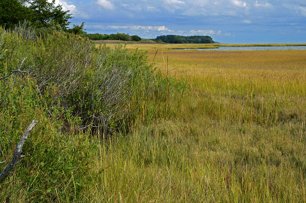
Mutton Hunk Fen Natural Area Preserve is located on the seaside of Accomack County on Virginia's Eastern Shore. The protected acreage fronts on Gargathy Bay on the east and is bounded by Whites Creek and Mutton Hunk Branch on the north. A conservation focus of this protected area is the occurrence of a globally rare sea-level fen community - one of only four in Virginia. Sea-level fens are open, freshwater wetlands located between uplands and wide, oceanside tidal marshes. The freshwater wetland vegetation is sustained by springs at the upland edge that provide large volumes of fresh groundwater. The low nutrient content of the groundwater and the acidic conditions of the soil strongly influence the types of plants found in sea-level fens. The vegetation consists of an interesting combination of acid-tolerant bog plants and tidal freshwater wetland plants capable of surviving in low nutrient areas. Due to this natural community’s sensitive balance of freshwater input, any amount of sea-level rise can be detrimental to the habitat and its plant life.
220 acres formerly under private lease for agricultural production have been converted to migratory songbird habitat, as originally prescribed in the sale agreement. While most of the property was planted with native shrubs and trees to accelerate the successional process, almost 15 acres are maintained as grassland to support a wider diversity of resident and migratory birds. This preserve is also part of the DWR Virginia Birding and Wildlife Trail.
The protection of this and other properties in the area is a cooperative effort of the Virginia Department of Conservation and Recreation, The Nature Conservancy and the Virginia Eastern Shore Land Trust.
VISITATION:
Public access facilities include a parking lot and two walking trails - one to the marsh overlooking Gargathy Bay and one along White's creek. Please obey the parking capacity of eight vehicles, park only in designated spaces, stay on designated trails and minimize your impacts to the natural resources at Mutton Hunk. If you arrive to find the preserve at full capacity, please come back later.
Research is conducted on various Preserves, research permit applications are available online.
DRIVING DIRECTIONS:
Traveling on US 13.
From the north, turn left onto Route 676 (Mutton Hunk Rd). Continue 0.9 mile to stop sign and turn right on Route 679 (Metompkin Rd). Continue 0.6 mile and turn right onto Route 742 (Baker Rd). Continue 1.2 miles, the road becomes gravel, to the parking lot at the terminus.
From the south, turn right onto Route 679 (Metompkin Rd). Continue 1.4 miles and turn right onto Route 742 (Baker Rd). Continue 1.2 miles, the road becomes gravel, to the parking lot at the terminus.
ACKNOWLEDGEMENTS:
Part of the acquisition of this preserve was funded by the Virginia Coastal Zone Management Program at the Department of Environmental Quality through Grant # NA10NOS4190205 of the U.S. Department of Commerce, National Oceanic and Atmospheric Administration, under the Coastal Zone Management Act of 1972, as amended.
CONTACT:

